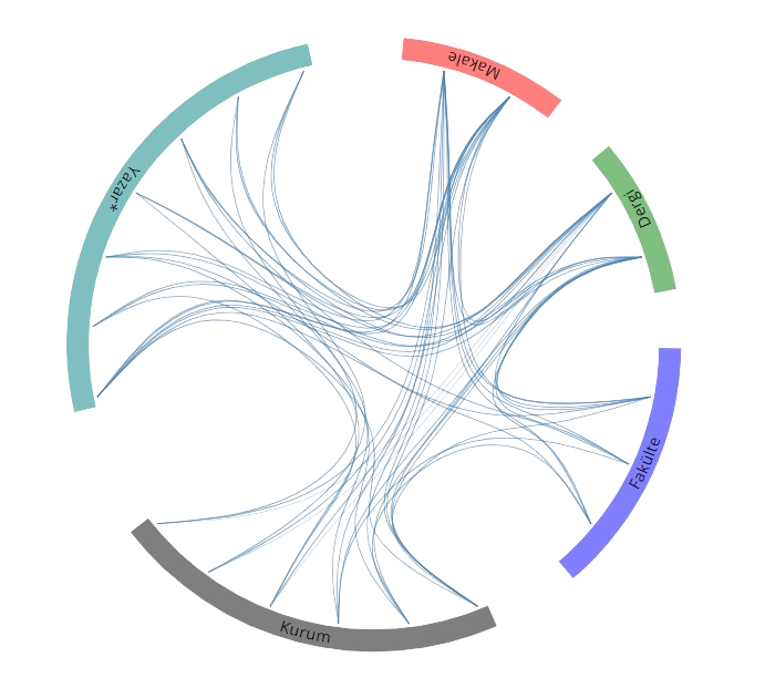
Yayınlar & Eserler

SCI, SSCI ve AHCI İndekslerine Giren Dergilerde Yayınlanan Makaleler

Diğer Dergilerde Yayınlanan Makaleler

Hakemli Kongre / Sempozyum Bildiri Kitaplarında Yer Alan Yayınlar

CROP HEIGHT ESTIMATION OF WHEAT USING SENTINEL-1 SATELLITE IMAGERY: PRELIMINARY RESULTS

8th International Conference on GeoInformation Advances, GeoAdvances 2024, İstanbul, Türkiye, 11 - 12 Ocak 2024, cilt.48, ss.267-273 Creative Commons License Sürdürülebilir Kalkınma identifier

TRENDS ANALYSIS OF AGRICULTURAL DROUGHT IN CENTRAL ANATOLIAN BASIN, TURKEY

8th International Conference on GeoInformation Advances, GeoAdvances 2024, İstanbul, Türkiye, 11 - 12 Ocak 2024, cilt.48, ss.141-148 Creative Commons License identifier

PREDICTION OF LONG-TERM SENTINEL-1 INSAR TIME SERIES ANALYSIS

39th International Symposium on Remote Sensing of Environment, ISRSE 2023, Antalya, Türkiye, 24 - 28 Nisan 2023, cilt.48, ss.3-8 Creative Commons License identifier

EVALUATION OF DEM DERIVED BY REPEAT-PASS X-BAND STRIPMAP MODE PAZ DATA

24th ISPRS Congress on Imaging Today, Foreseeing Tomorrow, Nice, Fransa, 6 - 11 Haziran 2022, cilt.43-B3, ss.243-248 Creative Commons License identifier identifier

Accuracy Evaluation of UAV-Derived Products

ISAG-International Symposium on Applied Geoinformatics, İstanbul, Türkiye, 7 - 09 Kasım 2019

ACCURACY EVALUATION OF UAV-DERIVED PRODUCTS BASED ON DIFFERENT FLYING ALTITUDES

International Symposium on Applied Geoinformatics (ISAG-2019), İstanbul, Türkiye, 7 - 09 Kasım 2019, ss.1-6 Creative Commons License Sürdürülebilir Kalkınma

A Booster Analysis of Extreme Gradient Boosting for Crop Classification using PolSAR Imagery

IEEE 8th International Conference on Agro-Geoinformatics (Agro-Geoinformatics 2019), Istanbul, Turkey, Türkiye, 16 - 19 Temmuz 2019, ss.1-4 identifier

EVALUATING THE CLOUDE-POTTIER DECOMPOSITION FOR CROP CLASSIFICATION USING MULTI-TEMPORAL RADARSAT-2 DATA

POLinSAR 2019, the 9th International Workshop on Science and Applications of SAR Polarimetry and Polarimetric Interferometry, Frascati, İtalya, 28 Ocak 2019, ss.1-2 Creative Commons License Sürdürülebilir Kalkınma

An application of roll-invariant polarimetric features for crop classification from multi-temporal RADARSAT-2 SAR data

2018 ISPRS Technical Commission I Midterm Symposium on Innovative Sensing - From Sensors to Methods and Applications, Karlsruhe, Almanya, 10 - 12 Ekim 2018, cilt.42, ss.451-456 Creative Commons License identifier

Classification of forested areas using morphological profiles in dual polarized ALOS/ PALSAR data

IX Conference of the Italian Society of Remote Sensing, Floransa, İtalya, 04 Temmuz 2018, ss.115 Sürdürülebilir Kalkınma

ASSESSMENT OF VEGETATION INDICES FOR THE DETERMINATION OF AGRICULTURAL CROP TYPES

B.EN.A. CONFERENCE ENVIRONMENTAL ENGINEERING AND SUSTAINABLE DEVELOPMENT, Alba Iulia, Romanya, 25 - 27 Mayıs 2017, ss.218

Nesne Tabanlı Sınıflandırma Yöntemi İle Tarımsal Ürün Deseninin Belirlenmesi

IX. TUFUAB TEKNİK SEMPOZYUMU, AFYONKARAHİSAR, Türkiye, 27 - 29 Nisan 2017

LAND COVER MAPPING USING SENTINEL-1 SAR DATA

23rd Congress of the International-Society-for-Photogrammetry-and-Remote-Sensing (ISPRS), Prague, Çek Cumhuriyeti, 12 - 19 Temmuz 2016, cilt.41, ss.757-761 Creative Commons License identifier identifier

Coastal Zone Detection in Istanbul using Landsat 8 OLI Image

27th International Cartographic Conference, Rio De Janeiro, Brezilya, 23 Ağustos 2015, ss.1

Spektral Band ve Bitki İndeksi Seçiminin Ürün Deseni Sınıflandırma Doğruluğuna Etkisi Karşılaştırmalı Analiz

Türkiye Ulusal Fotogrametri ve Uzaktan Algılama Birliği (TUFUAB) VIII. Teknik Sempozyumu 21-23 Mayıs, Konya, Türkiye, 21 - 23 Mayıs 2015

Crop Type Classification Using Vegetation Indices of RapidEye Imagery

ISPRS Technical Commission VII Symposium, İstanbul, Türkiye, 29 Eylül - 02 Ekim 2014

İnterferometrik SAR Yöntemi İle Maden Alanlarinda Meydana Gelen Çökmelerin Belirlenmesi

JEOUZAL-2014 jeolojik Uzaktan Algılama Sempozyumu, Antalya, Türkiye, 13 - 14 Mart 2014

Analysis of deformation patterns through advanced dinsar techniques in Istanbul Megacity

ISPRS Technical Commission VII Mid-Term Symposium 2014, İstanbul, Türkiye, 29 Eylül - 02 Ekim 2014, cilt.40, ss.19-21 Creative Commons License identifier

Fusion and Classification of Synthetic Aparture Radar and Multispectral Sattellite Data

22nd IEEE Signal Processing and Communications Applications Conference (SIU), Trabzon, Türkiye, 23 - 25 Nisan 2014, ss.754-757 identifier identifier

Destek Vektor Makineleri Teknigi ile Siniflandirma: RapidEye Ornegi

Türkiye Ulusal Fotogrametri ve Uzaktan Algılama Birliği VII. Teknik Sempozyumu (TUFUAB’2013), Trabzon, Türkiye, 23 Mayıs 2013, ss.1-5

FUSION OF TERRASAR-X AND RAPIDEYE DATA: A QUALITY ANALYSIS

ISPRS Conference on Serving Society with Geoinformatics (SSG), Antalya, Türkiye, 11 - 17 Kasım 2013, ss.27-30 Creative Commons License identifier identifier

Comparison of Neural Network and ISODATA Classi?ers for Land Cover Assessment Using Optical Data

FIG Commission 3 Workshop 2012 Spatial Information, Informal Development, Property and Housing, Atina, Yunanistan, 10 Aralık 2012, ss.1

SAR Görüntülerinden Kıyı Şeridi Belirleme Algoritması

IV. UZAKTAN ALGILAMA VE COĞRAFİ BİLGİ SİSTEMLERİSEMPOZYUMU, Zonguldak, Türkiye, 16 - 19 Ekim 2012

Mapping Crop Types by Using Rapideye Data in Menemen Plain İzmir

8th International Soil Science Congress on “Land Degradation and Challenges in Sustainable Soil Management", İzmir, Türkiye, 15 - 17 Mayıs 2012, ss.168-169

DETERMINING THE TECHNICAL STANDARDS OF PING PONG TABLE BY USING CLOSE RANGE PHOTOGRAMMETRY

22nd Congress of the International-Society-for-Photogrammetry-and-Remote-Sensing, Melbourne, Avustralya, 25 Ağustos - 01 Eylül 2012, ss.1-4 identifier identifier

InSAR Time Series Analysis of Coal Mining in Zonguldak City Northwestern Turkey

Fringe 2011 Workshop, Advances in the Science and Applications of SAR Interferometry and Sentinel-1 Prepetary Workshop, Frascati-Rome, İtalya, 1 - 07 Eylül 2011 Sürdürülebilir Kalkınma

An algorithm for coastline detection using SAR images

XXII ISPRS Congress"Imaging a Sustainable Future", Beijing, Çin, 25 Ağustos - 01 Eylül 2012 identifier identifier

Sustainable And Economically Recycling Real Estate Development Project: A Case Study For Istanbul Park

International Conference on Environment: Survival and Sustainability, Lefkoşa, Kıbrıs (Kktc), 19 - 24 Şubat 2007

Clustering of Buildings Based on Geospatial Characteristics and Relations for Generalization of Medium Scale Topographic Maps in an Object-Oriented GIS

Workshop On Spatial/Spatio-Temporal Data Mining (SDM) and Learning, ISPRS Commission II/2, Ankara, Türkiye, 24 Kasım 2005

3D Modelling And Visualization Using Photogrammetric Data

24th Urban Data Management Symposium, Venedik, İtalya, 01 Ocak 2004, ss.1

Kitap & Kitap Bölümleri

The Role of SAR Remote Sensing to Detect Oil Pollution and Emergency Intervention

OIL SPILL ALONG THE TURKISH STRAITS SEA AREA; ACCIDENTS, ENVIRONMENTAL POLLUTION, SOCIO-ECONOMIC IMPACTS AND PROTECTION, Ünlü S., Alpar B., Öztürk B., Editör, Türk Deniz Araştırmaları Vakfı, İstanbul, ss.157-175, 2018 Sürdürülebilir Kalkınma

Fotoğrafik Sistem Bileşenleri

Uzaktan Algılama ve Görüntü Yorumlama, Kavak K.Ş., Editör, Palme Yayınevi, Ankara, ss.150-180, 2018

Bölüm5: Global Konum Belirleme Sistemleri ve Temel Harita Bilgisi

Tarımda Uzaktan Algılama Tekniği, Prof. dr. Yusuf kurucu, Editör, Demfo, ss.117-152, 2017

A Sustainable and Economically Recycling Real Estate Development Project: A Case Study for Istanbul Park

Survival and Sustainability, H. Gökçekus, U. Türker, J.W. LaMoreaux, Editör, Springer, Berlin Heidelberg, ss.315-327, 2017

Bölüm 2 Uzaktan Algılama Yöntemleri ve Uydu Görüntüsü Temel İşleme Adımları

Tarımda Uzaktan Algılam Tekniği, Prof. Dr. Yusuf Kurucu, Editör, DEMFO, ss.23-74, 2017

Metrikler

Yayın

125

Atıf (WoS)

298

H-İndeks (WoS)

10

Atıf (Scopus)

387

H-İndeks (Scopus)

10

Proje

20

Fikri Mülkiyet

1

Tez Danışmanlığı

2

Açık Erişim

78
BM Sürdürülebilir Kalkınma Amaçları