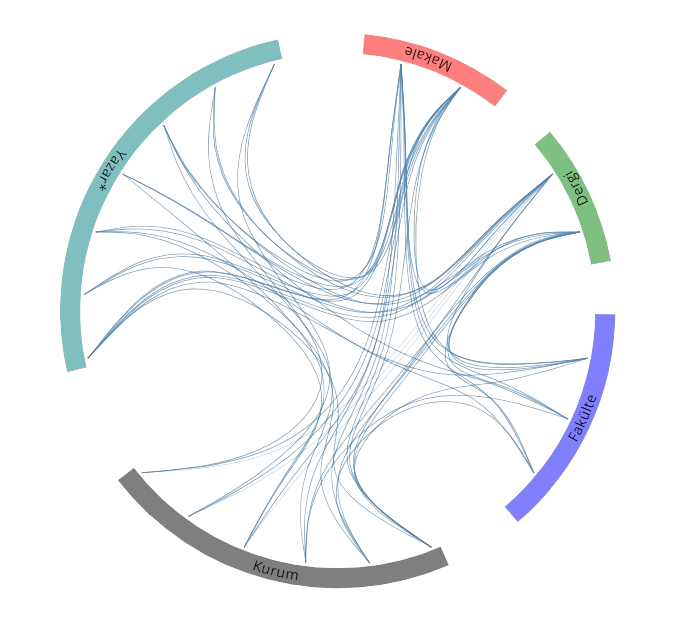
Yayınlar & Eserler

SCI, SSCI ve AHCI İndekslerine Giren Dergilerde Yayınlanan Makaleler 15
Diğer Dergilerde Yayınlanan Makaleler 13
Hakemli Bilimsel Toplantılarda Yayımlanmış Bildiriler 45

1. YOL TİTREŞİM VERİLERİNİ AKILLI MOBİL CİHAZLA TOPLAMAK İÇİN VERİ TOPLAMA MODELİ GELİŞTİRİLMESİ

2.INTERNATIONAL SELÇUK SCIENTIFIC RESEARCHES CONGRESS, Konya, Türkiye, 21 - 22 Ekim 2023, ss.414-415, (Özet Bildiri) Creative Commons License Sürdürülebilir Kalkınma

2. 3B CBS ve YBM-CBS Bütünleşmesi Konusunda Başlıca Çalışmalarve Eğilimler

19. Türkiye Harita Bilimsel ve Teknik Kurultayı, Ankara, Türkiye, 4 - 06 Ekim 2023, (Tam Metin Bildiri) Creative Commons License Sürdürülebilir Kalkınma

4. Ulaşım Veri Standartları İçin Çok Kriterli Karar Vermeye Yönelik Karşılaştırma Matrisi Oluşturulması

1st International Conference on Scientific and Academic Research, Konya, Türkiye, 10 - 13 Aralık 2022, ss.417, (Özet Bildiri) Creative Commons License

5. Selection of Hydrographic Objects in NHD 100K Streams from NHD 24K Streams using Drainage Networks Derived from Digital Elevation Models

8th International Conference on Geographical Information Systems Theory, Applications and Management (GISTAM), ELECTR NETWORK, 27 - 29 Nisan 2022, ss.130-137, (Tam Metin Bildiri) Creative Commons License identifier identifier

6. A CONCEPTUAL MODEL FOR GEO-OBJECT MATCHING

International Symposium on Applied Geoinformatics (ISAG-2019), İstanbul, Türkiye, 7 - 09 Kasım 2019, cilt.1, sa.1, ss.97-102, (Tam Metin Bildiri) Creative Commons License

7. EDGE EFFECTS BETWEEN THE BORDERS OF TWO ADJACENT DIGITAL ELEVATION MODELS

International Symposium on Applied Geoinformatics (ISAG-2019), İstanbul, Türkiye, 7 - 09 Kasım 2019, cilt.1, sa.1, ss.526-530, (Tam Metin Bildiri) Creative Commons License

8. SELECTION OF HYDROGRAPHIC OBJECTS IN TOPO50 DATABASE FROM TOPO25 DATABASE USING DRAINAGE NETWORKS DERIVED FROM DIGITAL ELEVATION MODELS

International Symposium on Applied Geoinformatics (ISAG-2019), İstanbul, Türkiye, 7 - 09 Kasım 2019, cilt.1, sa.1, ss.92-96, (Tam Metin Bildiri) Creative Commons License

9. Hiyerarşik ve K-Ortalamalar Yöntemleriyle Grid Noktalarının Kümelenmesi

17. Türkiye Harita Bilimsel ve Teknik Kurultayı, Ankara, Türkiye, 25 - 27 Nisan 2019, ss.1-8, (Tam Metin Bildiri) Creative Commons License

10. SU VE ATIKSU HATLARI İÇİN KONUM TABANLI ARTIRILMIŞ GERÇEKLİKUYGULAMASI GELİŞTİRİLMESİ

TUFUAB X. Teknik Sempozyumu, Aksaray, Türkiye, 25 - 27 Nisan 2019, ss.352-355, (Tam Metin Bildiri) Creative Commons License

12. A CASE STUDY ON MAP ACTIVITIES WITH CHILDREN OF KINDERGARTEN AGE

7th International Conference on Cartography and GIS, Sozopol, Bulgaristan, 18 - 23 Haziran 2018, ss.202-209, (Tam Metin Bildiri) Creative Commons License identifier

13. DETERMINING TRANSFORMATION METHOD FOR THE ALIGNMENT PROCESS OF ROAD MATCHING

INTERNATIONAL SYMPOSIUM ON GIS APPLICATIONS IN GEOGRAPHY & GEOSCIENCES, Çanakkale, Türkiye, 18 - 21 Ekim 2017, ss.78, (Özet Bildiri) Creative Commons License

14. AN APPLICATION DEVELOPMENT FOR USE OF BOREHOLE DATA ON IOS BASED MOBILE DEVICES

INTERNATIONAL SYMPOSIUM ON GIS APPLICATIONS IN GEOGRAPHY & GEOSCIENCES, Çanakkale, Türkiye, 18 - 21 Ekim 2017, ss.162-170, (Tam Metin Bildiri) Creative Commons License

15. 1878 Tarihli Davutpaşa Haritasının Planimetrik Doğruluk Analizi

6. Uzaktan Algılama ve Coğrafi Bilgi Sistemleri Sempozyumu (UZALCBS2016), Adana, Türkiye, 5 - 07 Ekim 2016, ss.1191-1196, (Tam Metin Bildiri) Creative Commons License

18. DEVELOPING TOOLS FOR COMPUTATION OF BASIN TOPOGRAPHIC PARAMETERS IN GIS

3rd International GeoAdvances Workshop / ISPRS Workshop on Multi-dimensional and Multi-Scale Spatial Data Modeling, İstanbul, Türkiye, 16 - 17 Ekim 2016, ss.165-168, (Tam Metin Bildiri) Creative Commons License Sürdürülebilir Kalkınma identifier identifier

19. Determining Weights of the Attributes in the Model Generalization of River Networks

26th International Cartographic Conference, Dresden, Almanya, 25 - 30 Ağustos 2013, (Tam Metin Bildiri) Creative Commons License

20. A Case Study on Map Conflation by Open Source GIS

INSPIRE Conference, Florence, İtalya, 23 - 27 Haziran 2013, (Yayınlanmadı) Creative Commons License

21. Kümelemede Normalleştirmenin Etkisi

14. Türkiye Harita Bilimsel ve Teknik Kurultayı, Ankara, Türkiye, 14 - 17 Mayıs 2013, (Tam Metin Bildiri) Creative Commons License

22. Türk Haritacılığının Bilinmeyen Eserlerinden Biri: 1878 Tarihli Davutpaşa Haritası

14. Türkiye Harita Bilimsel ve Teknik Kurultayı, Ankara, Türkiye, 14 - 17 Mayıs 2013, ss.1-8, (Tam Metin Bildiri) Creative Commons License

23. Taşkın Risk Yönetiminde Sayısal Arazi Altyapısı

3. Ulusal Taşkın Sempozyumu, İstanbul, Türkiye, 29 - 30 Nisan 2013, ss.332-341, (Tam Metin Bildiri) Creative Commons License

24. Hidrografik Genelleştirmede Seçme Eleme İşlemi için Yapay Sinir Ağı Yöntemlerinin Uygulanabilirliği

YTÜ İnşaat Fakültesi Bilim Şenliği, İstanbul, Türkiye, 21 - 22 Mayıs 2012, (Tam Metin Bildiri) Creative Commons License

25. CLUSTERING APPROACHES FOR HYDROGRAPHIC GENERALIZATION

9th International Symposium on Surface Models for Geosciences (GIS), Ostrava, Çek Cumhuriyeti, 23 - 25 Ocak 2012, ss.241-260, (Tam Metin Bildiri) Creative Commons License identifier

26. Ada Temelli Bir Yol Ağı Seçme Eleme Yöntemi

TMMOB Coğrafi Bilgi Sistemleri Kongresi, Antalya, Türkiye, 31 Ekim - 04 Kasım 2011, (Tam Metin Bildiri) Creative Commons License

27. Hydrographic Selection Elimination in Automated Generalization by Using Artificial Neural Networks

25th International Cartographic Conference, Paris, Fransa, 3 - 08 Temmuz 2011, (Özet Bildiri) Creative Commons License

28. A GIS Approach to Fire Station Location Selection

4th International Symposium on Geo-information for Disaster Management, Gi4DM 2011, Antalya, Türkiye, 3 - 08 Mayıs 2011, (Tam Metin Bildiri) Creative Commons License identifier

29. Yükseklik Eğrilerinin Karakteristik Noktalarının Belirlenmesi ve Basitleştirilmesi

Genelleştirme ve Çoklu Gösterim Çalıştayı, Bursa, Türkiye, 12 - 13 Eylül 2009, ss.30, (Özet Bildiri) Creative Commons License

30. Selection of Roads for Cartographic Generalization

INTERNATIONAL ARCHIVES OF PHOTOGRAMMETRY REMOTE SENSINGAND SPATIAL INFORMATION SCIENCES, Beijing, Çin, 3 - 11 Temmuz 2008, cilt.37, ss.615-620, (Tam Metin Bildiri) Creative Commons License

31. GIS and Cartography for Mountain Activities and Natural Resources

Second International Conference on Cartography and GIS, Sofija, Bulgaristan, 21 - 24 Ocak 2008, ss.293-300, (Tam Metin Bildiri) Creative Commons License Sürdürülebilir Kalkınma

32. Cartographic Generalization and Agent Technology for Road Data

2nd International Conference on Cartography and GIS, Sofija, Bulgaristan, 21 - 24 Ocak 2008, ss.307-314, (Tam Metin Bildiri) Creative Commons License

33. Çok Uyarlayıcılı Sistemde Yol Verileri için Kartografik Genelleştirme Uygulaması

TMMOB Coğrafi Bilgi Sistemleri Kongresi, Trabzon, Türkiye, 30 Ekim - 02 Kasım 2007, ss.795-807, (Tam Metin Bildiri) Creative Commons License

34. Dağcılık Faaliyetlerine Yönelik Coğrafi Bilgi Sistemi Oluşturulması ve Tematik Harita Üretimi

TMMOB Coğrafi Bilgi Sistemleri Kongresi, Trabzon, Türkiye, 30 Ekim - 02 Kasım 2007, ss.742-747, (Tam Metin Bildiri) Creative Commons License Sürdürülebilir Kalkınma

35. Effects of Watershed Delineation from Grid DEMs in GIS to Non-Point Source Water Pollution Modelling

14th Symposium on Environmental Pollution and Its Impact on Life in the Mediterranean and Health, Sevilla, İspanya, 10 - 14 Ekim 2007, ss.141, (Özet Bildiri) Creative Commons License

36. Comparison of Drainage Networks Extracted from DEMs Automatically Using Accumulation Values and PPA

23rd International Cartographic Conference, Moscow, Rusya, 4 - 10 Ağustos 2007, (Tam Metin Bildiri) Creative Commons License

37. Watershed Delineation from Grid DEMs in GIS: Effects of Drainage Lines and Resolution

10th International Conference on Diffuse Pollution und Sustainable Watershed Management, International Water Association, DipCon 2006, İstanbul, Türkiye, 18 - 22 Eylül 2006, (Tam Metin Bildiri) Creative Commons License

38. Harita Çizim Programları ve Büyük Ölçekli Topoğrafik Haritalar

HKMO Sürekli Teknik - Bilimsel Komisyonlar Geçmişi, Misyonları, Yeniden Yapılanma Gereksinimleri, Gelecek Projeksiyonları Çalıştayı, Kocaeli, Türkiye, 24 - 26 Eylül 2004, (Yayınlanmadı) Creative Commons License

39. Automatic Extraction of Terrain Skeleton Lines From Digital Elevation Models

ISPRS XXth Congress, İstanbul, Türkiye, 12 - 23 Temmuz 2004, cilt.35, ss.372-377, (Tam Metin Bildiri) Creative Commons License

40. Comparison of Two Methods for Deriving Skeleton Lines of Terrain

ISPRS XXth Congress, İstanbul, Türkiye, 12 - 23 Temmuz 2004, cilt.35, ss.618-622, (Tam Metin Bildiri) Creative Commons License

41. Geological Database of Istanbul

Third International Symposium on Remote Sensing of Urban Areas, İstanbul, Türkiye, 11 - 13 Haziran 2002, cilt.1, ss.444-451, (Tam Metin Bildiri) Creative Commons License

42. Geological and Geotechnical Information System for Istanbul

Fourth Turkish-German Joint Geodetic Days, Berlin, Almanya, 3 - 06 Nisan 2001, cilt.2, ss.853-858, (Tam Metin Bildiri) Creative Commons License

43. An Approach for Determination of Characteristic Points of Contours

Third Turkish-German Joint Geodetic Days, İstanbul, Türkiye, 1 - 04 Haziran 1999, cilt.1, ss.41-48, (Tam Metin Bildiri) Creative Commons License

44. Derivation of Characteristic Lines from a Specific Digital Terrain Model

International Symposium on GIS/GPS, İstanbul, Türkiye, 15 - 19 Eylül 1997, ss.67-75, (Tam Metin Bildiri) Creative Commons License

45. Sayısal Ortamda Kartografik Genelleştirme

5. Harita Kurultayı, Ankara, Türkiye, 31 Ocak - 03 Şubat 1995, ss.86-101, (Tam Metin Bildiri) Creative Commons License